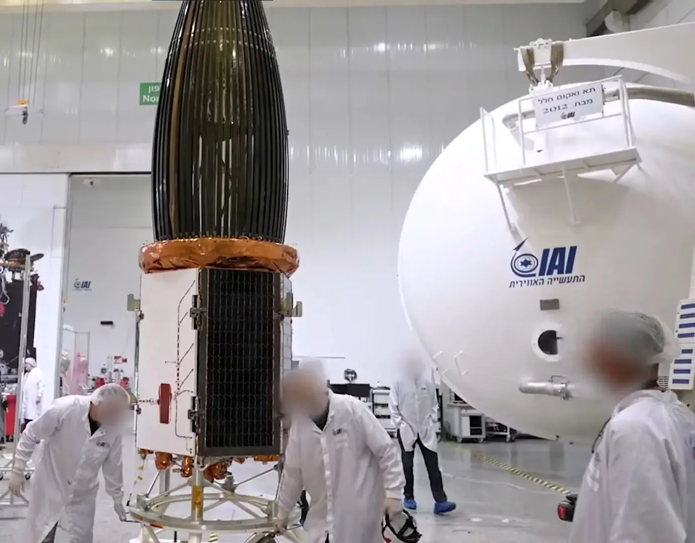
Like other IAI-made satellites, TECSAR is compatible with most commercial launch service providers. Being lightweight and compact, it can be launched as “Ride Share” at a greatly reduced cost. Based on over four decades of space excellence and dozens of successful space missions, TECSAR is IAI’s state-of-the-art Synthetic Aperture Radar satellite system. Several TECSAR satellites are already in orbit, proving to be a reliable system that exceeds its planned mission life. Designed to the highest standards, TECSAR satellites are in constant use worldwide, supplying 24/7, all-weather, high-quality imagery of battlefields and strategic locations across the globe.
OVERVIEW
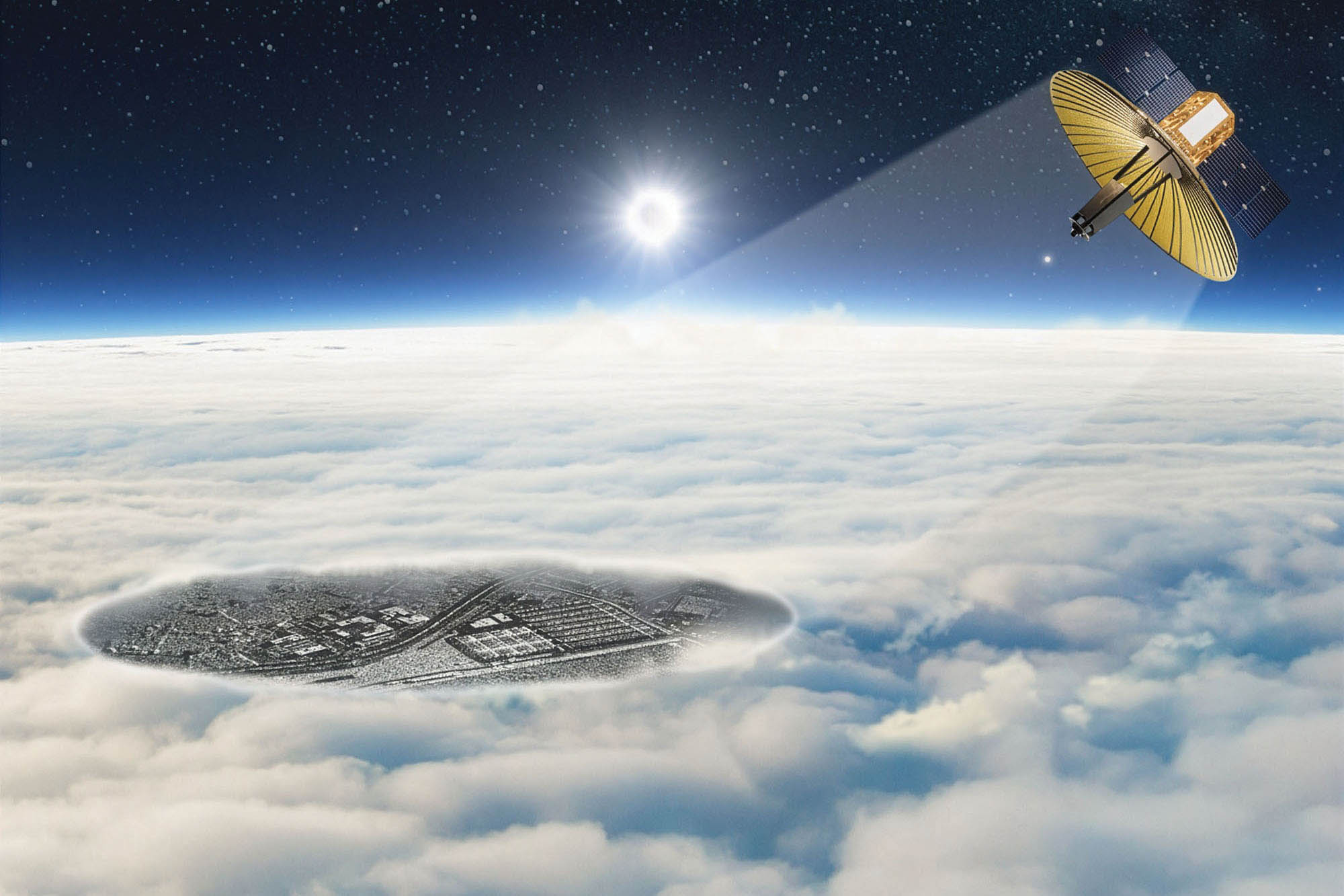
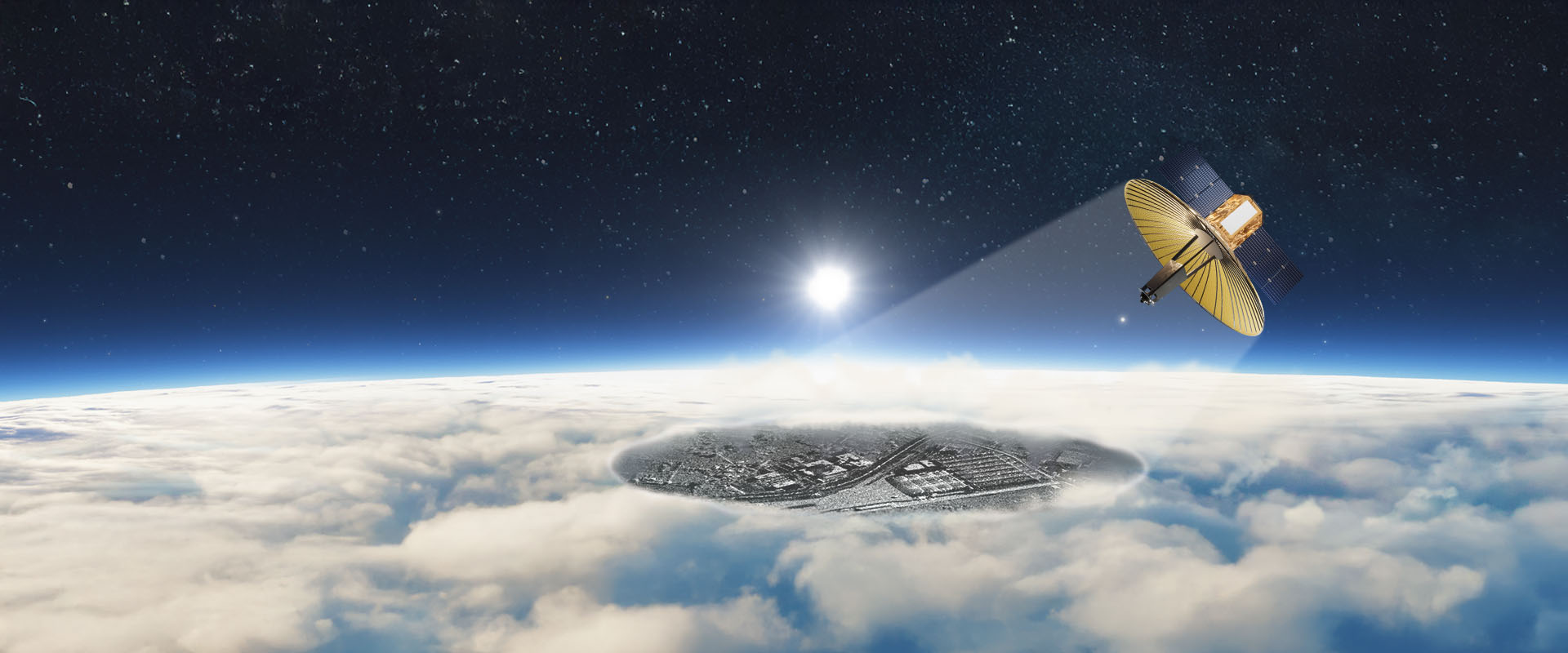
Modern armed forces rely on space-based observation satellites to gain a comprehensive, real-time view of the battlefield. Synthetic Aperture Radar (SAR) satellites provide clear imagery through clouds, smoke, and darkness, enabling continuous monitoring of troop movements, vehicle deployments, and potential threats for superior situational awareness in all conditions.
HIGHLIGHTS
- Multi-purpose application
- Multimode imaging capability
- Visibility in all weather and any time of day
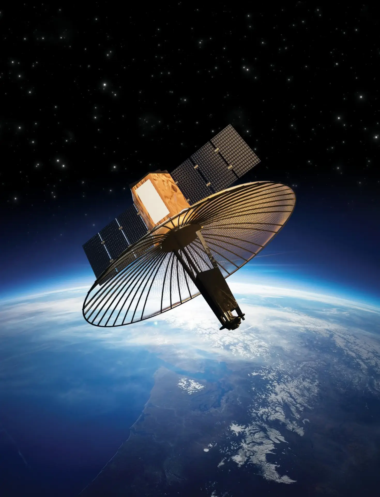
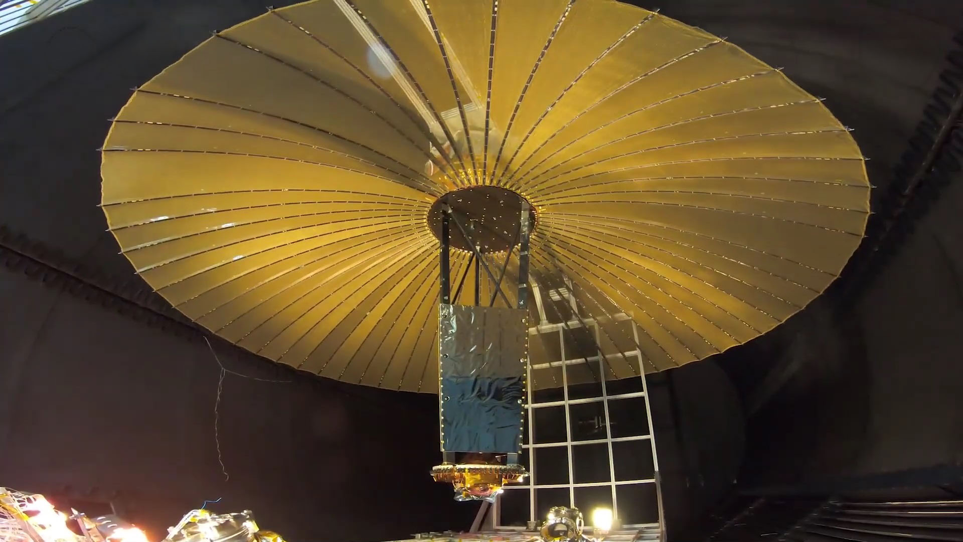
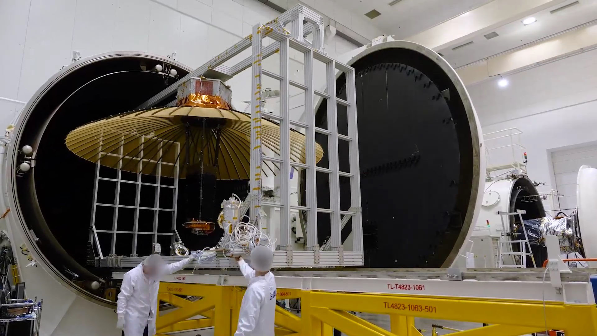
- Synthetic Aperture Radar (SAR) Satellite
Values & Benefits
The power of SAR observation extends far beyond just providing an image of the battlefield. SAR-based earth observation is available 24/7, in all weather, and in any lighting conditions. It can penetrate through debris as well as vegetation cover, revealing what really lies behind.
IAI’s TECSAR is an advanced radar observation satellite that utilizes a SAR-based payload. Unlike EO satellites that need daylight and a clear line of sight to the target, SAR uses electromagnetic energy beams to create images. With its advanced payload, TECSAR provides very high-resolution imagery of locations on Earth for both defence and homeland security applications. The SAR radar satellite is lightweight and agile, capable of quick maneuvers to acquire many targets or scan large areas in a short time.
TECSAR has extremely high location accuracy and excellent image quality, making it an ideal source of imagery data acquisition for both civil and military applications. In harsh weather, lighting conditions, and environments where precision is critical for operational success and can save lives, the TECSAR radar observation satellite, augmented by IAI’s innovative ground segment software and advanced data processing, delivers multi-level accurate data with unprecedented speed.